We frequently receive questions about the signage of hiking trails, running routes, and biking routes. On this page, we've summarized the most important information about signage for you. The examples shown below represent the uniform concept currently being implemented in the Schladming-Dachstein region. This concept was launched in 2024 and will be implemented on an ongoing basis, meaning it may take some time until all signs throughout the region comply with these standards. However, in terms of basic orientation, most other systems currently in use are similarly structured.
Hiking signage
-
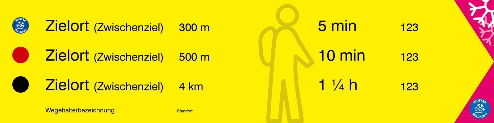
Sign size: 600 x 150 mm
-
Content: 1-3 lines with difficulty level, destination, walking time or distance, and the trail number.
-
Winter suitability: A magenta arrowhead indicates that the route is accessible from this point in winter. There is also an icon for winter hiking or snowshoeing.
-
Winter icons: If a hiking destination is also accessible in winter, the corresponding icon is displayed in the difficulty level section of the sign.
-
Distance information: In addition to the destination, a distance can optionally be specified, as distances are often more helpful than walking times in winter.
-
-
Reason for winter integration: This saves on signs and maintenance costs, as year-round accessible routes do not require seasonal installation or removal.
-
Footer: Contains the trail marker, location number, location name, and pictograms of circular trails if they run along the route.
-
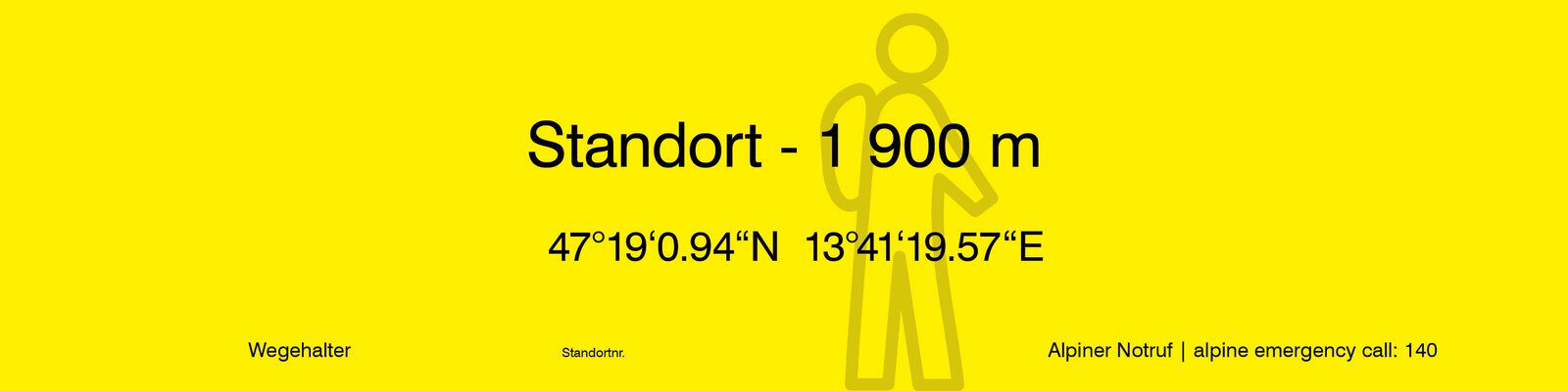
Location sign: Shows the location name, elevation, and coordinates. The footer also contains the trail marker, location number, and the alpine emergency number.
Winter hikes
without summer route
-
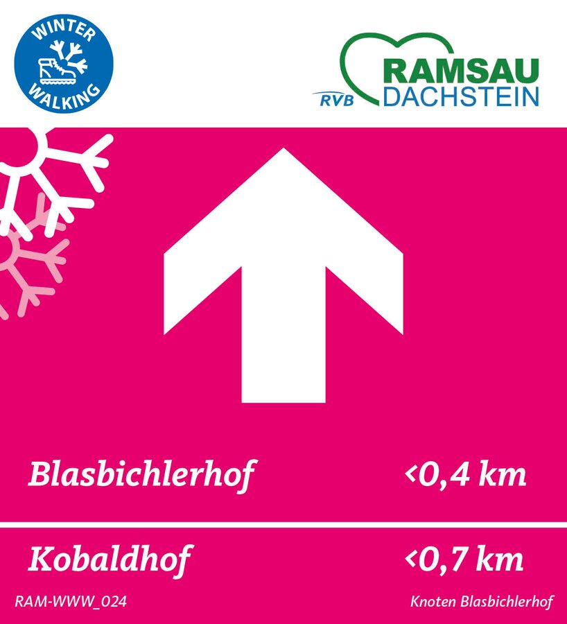
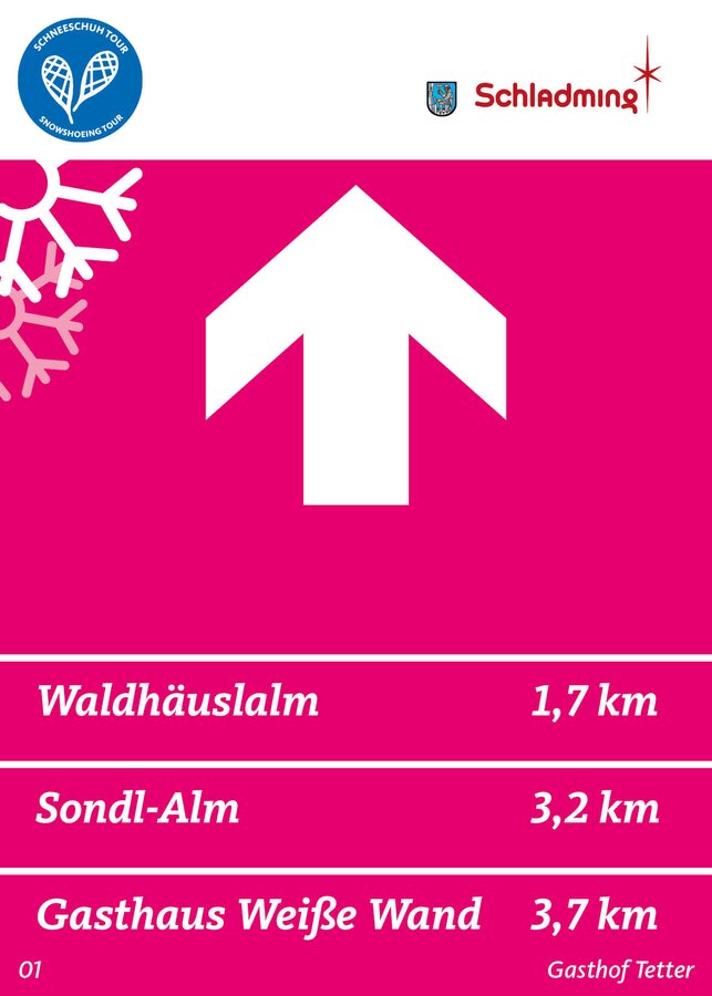
Winter or snowshoe hiking icon: Indicates whether the route is suitable for winter or snowshoe hiking.
-
Trail maintenance logo: Identifies the person responsible for the route and the signage.
-
Directional arrow: Indicates the direction of travel.
-
Destination information: One to several lines with destinations and optional distance information (optional for circular routes).
-
Location information: Contains the location number and location name.
Bike signage
The state of Styria created a new cycling guidance system in 2024. This will be implemented on all cycle paths, mountain bike routes, and trails in the coming years, ensuring that visitors will find a consistent approach throughout the entire state. The concept is also very similar to existing concepts in other federal states, making cross-state orientation easy.
Running route signage
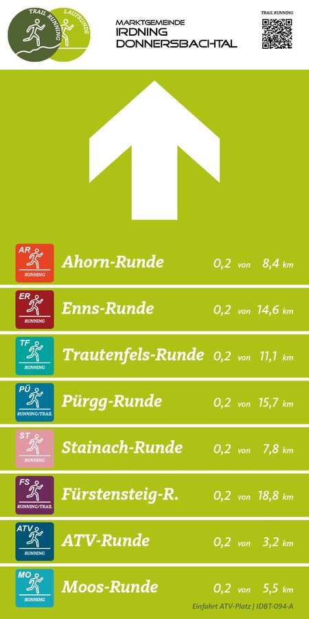
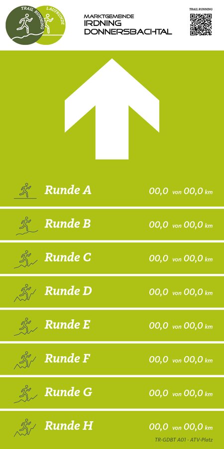
- Trail running/running icon & trail marker logo: At the top of the sign. Additionally, a QR code leading to the landing page for running routes.
- Directional arrow: Indicates the running direction.
- Running laps: One to several lines with individual icons, the lap name, and the information "x of y km."
- Location information: Contains the location and the location number.